Orrest Head is a rocky knoll of 238 metres immediately behind Windermere town, and it is the most important small hill in the Lake District. The path leaves the A591 through a gate opposite the railway station, climbs for about twenty minutes, and puts the whole of Windermere below you, with the Coniston fells, the Langdale Pikes and — on a clear day — the Scafell range beyond.
For the effort, there is nothing else like it in England. It is free, it is always open, and it is the walk to do before you do anything else.
In 1930 a twenty-three-year-old Blackburn council clerk came to the Lakes for the first time, walked up here from the station, and looked at the view. Alfred Wainwright later described the moment as the one that shaped the rest of his life. He went on to write the seven handwritten Pictorial Guides to the Lakeland Fells, which still tell a large part of Britain how to walk in these hills.
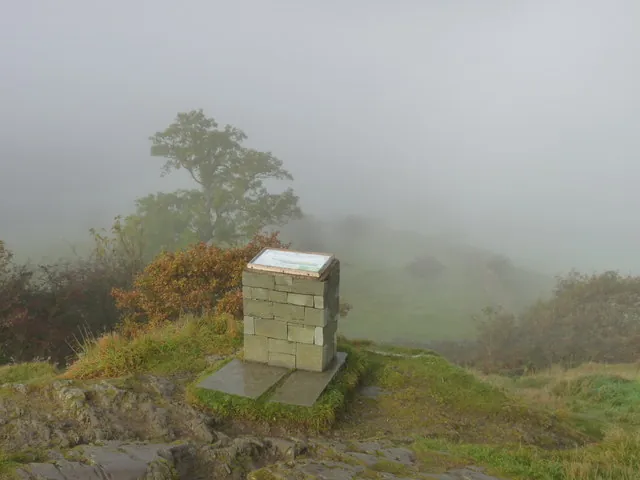
The summit has a bench, a viewfinder naming the fells, and a plaque quoting him. You do not need the plaque. The view is the argument. People who have never read a page of him still stop talking when they get to the top, which is the more useful test.
It is a pilgrimage for some. It is a short hill with a long view for everyone else. Both groups fit on the knoll, which is why the hour you pick matters.
From Windermere station, cross the A591 and look for the signposted gate. The path climbs through woodland on a broad track, eases, and comes out onto open ground near the top. A short rocky section leads to the summit knoll. Most people take it at a walk. Some use their hands for a move or two.
Time: about twenty minutes up, forty-five minutes round trip with time at the top.
Ascent: roughly 130 metres from the road.
Surface: a made track for most of the way, rougher rock at the summit. It is not wheelchair accessible. It is within reach of anyone who can manage a steady uphill walk, and children do it easily. After rain the path is mud; the rock at the top is slick.
There are two routes up, one gentler than the other. Both are signposted from the road. If you miss the gate you will be walking along a trunk road, which is the sign you have missed the gate.
There is nothing at the top — no café, no shelter, no toilets. It is open ground and it catches the weather. Carry a layer even if the station forecourt was warm.
The whole length of Windermere running south towards Lakeside. Belle Isle in the middle of it. The Coniston fells and the Langdale Pikes across the water, Fairfield and Red Screes to the north, the Howgills and the Yorkshire Dales hills away east on a clear day. It is a genuine 360-degree view, which a hill this small and this close to a town is not supposed to have.
Early morning and the last hour before sunset are the best light on Orrest Head, when Windermere takes the colour. In winter, on a cold clear day, the visibility is better than in a hazy August, and the summit is often empty. In the school holidays at eleven in the morning it is a viewing platform with a queue for the viewfinder.
The honest photograph includes the lake. A tight shot of a bench and a plaque could be any memorial.
Dawn, if you can. The town is asleep, the lake is a sheet, and you will have the knoll. Late evening in June and July, when the light lasts. Winter weekdays. Not a bank-holiday Saturday at noon unless you like sharing a small rock with fifty people.
The mountain forecast and the town forecast are closer here than they are on Helvellyn, but the top is still a hill. Cloud sits on it. Rain makes the rock unpleasant. Wind on the knoll is sharper than Windermere High Street.
It is open at all times because it is open-access land, not because it is a visitor centre. There is no one to close it.
On foot: everything in Windermere town is within ten minutes of the gate. That is the point.
By train: Windermere is the terminus of the branch from Oxenholme on the West Coast main line, roughly hourly. This is the closest thing the Lake District has to a fell you can climb from a railway platform. Do it before you collect the bags from the guest house, or after you have dumped them.
By bus: the 555 and 599 both stop in town.
By car: there is no dedicated car park. Use the town parks and walk. Circling the A591 looking for a lay-by next to the gate is how you start a twenty-minute walk with a twenty-minute temper. See parking in Windermere.
Trainers with a grip will do in the dry. After rain the woodland track is mud and the summit rock is a different surface. In winter it holds ice. There is no shame in turning round at the rocky step if it feels wrong; the view from the open ground just below is already most of the show.
A waterproof is not optional in this county. The station can be in sun while the knoll is in a shower that arrived up the lake.
The bench and the viewfinder are useful. The plaque is a sentence. None of them is the walk. People queue for the viewfinder in August as if it were a telescope; you can name the Langdales without it if you have looked at a map once.
The honest picture is the lake, not your face in front of the plaque. Dawn mist on the water, snow on the Coniston fells, a midwinter sun — those are the pictures this hill can still give you if you are willing to be up here when the gift shops are shut.
School Knott, east of the town, is 232 metres — a similar climb, a tarn below the summit, a view west over the lake to the Coniston fells, and a fraction of the traffic. It is not Wainwright’s hill. It is the better hill on an August Saturday afternoon.
Brant Fell, above Bowness, is the third of the short trio: steeper, with Belle Isle immediately below. Under an hour from the piers.
All three are in our walks guide. Orrest Head is still the one to do first.
Do it on arrival, from the station, before you have unpacked. Do it the morning you leave, if the light is better. Do not save it for “if we have time” — it is forty-five minutes, and it is the view the rest of the week is trying to live up to.
It pairs with a Bowness afternoon: hill, then lake. It does not pair well with a rushed dash to Stock Ghyll and a boat, unless you are willing to treat the knoll as twenty minutes and not linger. Lingering is the point.
Do not skip it because it looks small on the map. Do not drive around looking for a summit car park. Do not fly a drone over a knoll full of people eating sandwiches. Do not treat the A591 gate as a place to leave a car “just for twenty minutes”.
Orrest Head is free, close, and out of proportion to its height. Walk up from the station, give the view the time Wainwright did, and the rest of the southern Lakes will make more sense.