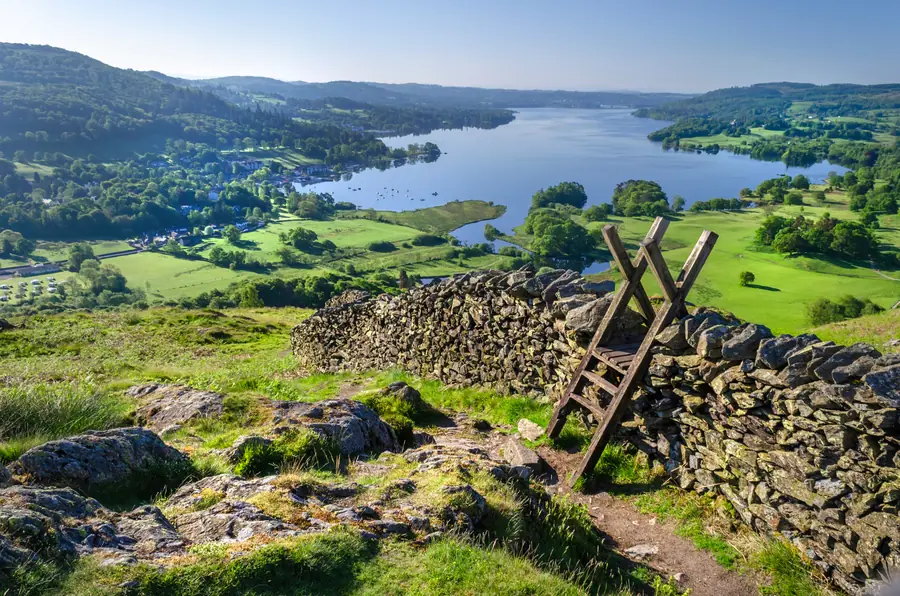
The Lake District is a mountainous region in Cumbria covering about 2,362 square kilometres — the largest national park in England, designated in 1951, and since 2017 a UNESCO World Heritage Site.
Windermere sits at its south-eastern gateway. The lake is the largest in England, the town is the end of the only railway line into the park, and for a great many visitors this is where the Lake District begins.
Sixteen lakes of significant size, of which only one — Bassenthwaite — is actually called a lake; the rest are meres and waters, a point local people will make if given the opportunity.
Every English mountain over 3,000 feet, including Scafell Pike at 978 metres, the highest point in England.
Wastwater, the deepest lake in England, and Windermere, the longest.
And a landscape of enclosed valleys, drystone walls, hefted sheep flocks and small farms that is as much a human creation as a natural one.
This is the interesting part, and it is frequently misunderstood. The Lake District was inscribed in 2017 not as a natural site but as a cultural landscape — under three headings.
Agro-pastoral farming. The system of hefted Herdwick flocks grazing common fell, with valley farms and drystone walls, which has shaped the landscape for a thousand years and largely survives.
The Picturesque and Romantic movements. The Lakes are where British ideas about landscape beauty were formed — by Wordsworth, Coleridge, De Quincey and the tourists who followed them — and those ideas were exported worldwide.
Conservation. The response to nineteenth-century development pressure here produced the National Trust, founded in 1895 by three people including Canon Hardwicke Rawnsley of Wray, and eventually the national park system itself. Beatrix Potter’s bequest of fifteen farms and over four thousand acres is a central part of that story.
So the sheep, the walls and the poets are the reason, as much as the mountains.
The lake first, because it is on the doorstep and because the cruises double as transport — Bowness to Ambleside, Bowness to Lakeside, and the chain ferry to the quiet western shore.
The nearest fells: Orrest Head above the town, twenty minutes for a view of the whole southern Lakes; Wansfell Pike above Ambleside for a first real fell.
The central valleys: Rydal and Grasmere north on the A591, Langdale beyond, Coniston and Hawkshead west across the ferry.
Further: Keswick and Borrowdale in the north, Ullswater over Kirkstone Pass, and Wasdale on the western side, which is the wildest of them.
Brockhole, five kilometres north, is the national park’s own visitor centre and the place to ask a ranger a question.
It is the wettest part of England. Plan for it, and note that a wet day at valley level is frequently a fine day for waterfalls, woods and the lake.
Check a mountain forecast rather than a valley one before going high. Cloud base and summit wind are the numbers that matter.
The fells are serious. Lake District mountain rescue teams are among the busiest in Britain, and the pattern is consistent: people misjudge the time, run out of daylight or lose the path in cloud.
It is busy. Twenty million visitor days a year, concentrated in the summer and in a handful of valleys. Going early, going midweek and going in the shoulder seasons transforms it.
Access: open access applies to most of the fell ground, and the rights of way network is dense. Leave gates as you find them, keep dogs under control near stock, and take everything home.
About 2,362 square kilometres — the largest national park in England.
It was inscribed in 2017 as a cultural landscape, for its hill-farming system, its role in the Picturesque and Romantic movements, and its part in the birth of the conservation movement.
Sixteen of significant size, though only Bassenthwaite is formally called a lake — the others are meres and waters.
Scafell Pike, at 978 metres, which is also the highest point in England.
The lake cruises, Orrest Head for the view, and Brockhole for the national park’s own visitor centre.